
Page 186 - คู่มือการใช้งานโปรแกรมQGIS
P. 186
178
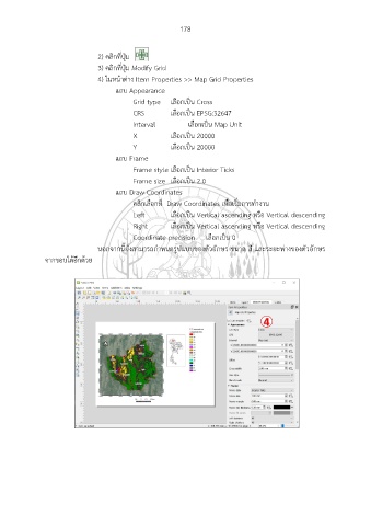
2) คลิกที่ปุ่ม
3) คลิกที่ปุ่ม Modify Grid
4) ในหน้าต่าง Item Properties >> Map Grid Properties
แถบ Appearance
Grid type เลือกเป็น Cross
CRS เลือกเป็น EPSG:32647
Interval เลือกเป็น Map Unit
X เลือกเป็น 20000
Y เลือกเป็น 20000
แถบ Frame
Frame style เลือกเป็น Interior Ticks
Frame size เลือกเป็น 2.0
แถบ Draw Coordinates
คลิกเลือกที่ Draw Coordinates เพื่อเริ่มการทำงาน
Left เลือกเป็น Vertical ascending หรือ Vertical descending
Right เลือกเป็น Vertical ascending หรือ Vertical descending
Coordinate precision เลือกเป็น 0
นอกจากนี้ยังสามารถกำหนดรูปแบบของตัวอักษร ขนาด สี และระยะห่างของตัวอักษร
จากขอบได้อีกด้วย